June 8, 2009


By Marty Basch
Mount Washington was hidden in the haze. It was 95 degrees on 2,532-foot Hedgehog Mountain and the haze was making mountain's at times seem like a mirage.
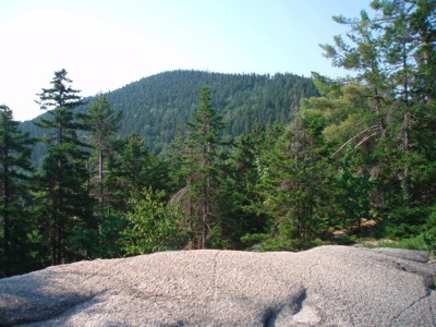
On Allen's Ledge, with its eastern viewpoints, the Moats, Carrigain and other mountains were like a desert mirage, coming and in out of focus.
But one peak remained solid, mighty and visible: the trapezoidal hulk of 4,043 foot Mount Passaconaway.
Where is it?
Hedgehog Mountain is not far from either Conway or Lincoln, with a trailhead off the Kancamagus Highway. Roughly mid-way between the two mountain towns on the roadway, the approximately five mile circuit up and over Hedgehog is a nice ledgy and edgy three hour jaunt to the land of spur trails leading to overlooks and blueberries waiting to be picked.
With its proximity to a couple of White Mountain National Forest campgrounds - Passaconway and Jigger Johnson - chances are the trailhead parking lot will have lots of out-of-state plates, say, from distant and wild lands like Kansas, Florida, and North Carolina.
In the early morning, there weren't other people, just deer flies using a bald crown as a landing strip. But that's what baseball caps are for and the runway was soon shut down.
Which way?
As with any circuit, the decision is always the same: which way first? Guide books have recommended both. Having done this loop along the UNH Trail (about 13 miles west of Conway from the Downes Brook parking area) in a clockwise direction, it was time to do it counterclockwise. It's not a bad way to go because the steeps are tackled first and on the way down, the east ledges keep those stellar outlooks coming.
This is the land of cross-country skiing, a small network of trails - the Olivarian-Downes Brook system - is marked with winter's blue diamond. The initial walking is easy, along an old logging road under towering pines. But a junction means the counterclockwise journey begins and it's up gently at first, and then more moderate.
Though hiking alone, one really is never alone in the woods. Chipmunks scampered on the thirsty ground while overhead songbirds chirped. After a mile, a steep spur leads to Allen’s Ledge and its huge boulder.
On the summit
The summit is one that features solitary ledges found by venturing off the main trail. Distant peaks were cloaked, but not Mount Passaconaway in the Sandwich Range. From many ledge platforms with stunted evergreens and other reaching high in the sky, Passaconaway's wooded crown is obvious. One of the state's 48 4,000 foot mountains, the mountain's name is a tribute to a Penacook tribe chief.
The beauty of the Hedgehog circuit is that once one descends back into the forest, that isn't it for getting close to the edge. Because there are more ledges on the way.
The eastern ledges have wonderful views of Mount Passaconaway. I probably shouldn’t tell you, but in season there are lots of blueberries there.
Hikers march on
But just after enjoying a handful of berries and re-entering the forest, the long ant line march of other hikers had begun. Over the course of the two miles down, about a dozen hikers of varying y'alls were passed.
The path continued by a few stream crossings, barely flowing. The gentle wind that had kept the insects away up top, couldn't contend with those deer flies waiting for the landing strip to reopen. It didn't. But it would be a good idea to take flight up a path to Mount Passaconaway one day.
One Tank Away
Conway is:
*52 miles from Franconia, N.H.
*233 miles from Wellfleet, Mass.
*245 miles from Bristol, Ct.


Copyright 2009 Marty Basch
Copyright 2009 Marty Basch
Copyright 2009 Marty Basch


