April 29, 2012


By Marty Basch
North Moat Mountain is a chiseled stage from which to see many White Mountain highlights. Though far less tall than the mile-high peaks off in the horizon, from its ledgy crown the sky is loaded with hiking and tourist landmarks.
The rocky crag that is Mount Chocorua is easily spotted. So is Conway Lake and the fire tower atop Kearsarge North. The ski trails on North Conway's Mount Cranmore are handily recognizable as are the Presidential peaks, Carter Range and sinuous Kancamagus Highway.
But North Moat is not the only dais from which to ponder. The Red Ridge Trail has its own magnificent look at much of the same scenery via a windswept rocky expanse that of itself is a worthy journey.
The Moat Mountains form a panoramic ridge west of North Conway. To traipse its length is a day well spent. North Moat is the king at 3196 feet, followed by Middle Moat at 2805 and South Moat at 2770 in a neighborhood of low scrub brushes, stark ridges and outstanding vantage points.
However, a day spent doing a strenuous 10-mile Moat Mountain and Red Ridge Trails circuit is also a day for hikers to remember.
The loop had eluded me over the years, but not the ridge walk done several times and always south to north.
On a day feeling closer to autumn than spring, I decided to do the solo hike counter-clockwise with an early morning start from the Diana's Bath trailhead on West Side Road near North Conway village. If there is a touch of the suburbs in the White Mountain National Forest it is along the well-manicured and packed path with benches, fences, bridge, picnic tables and steps leading about a half mile to the rushing waterfalls , ledges and potholes along the site of a former mill. In the early morning, the falls were vacant. On the return, be prepared to add to the chorus of hellos.
The Moat Mountain Trail is part logging road, a benign jaunt on the approach along the north bank of flowing Lucy Brook, a companion for some of the way. The gentle first mile or so was a lazy re-introduction to spring hiking complete with a few rock hopping crossings before the unforgiving steeps up a ridge to North Moat.
I had chosen the counter-clockwise direction because I wanted to do the punishing steeps first, and then later enjoy a leisurely descent along the wonderful desolate stretch of the Red Ridge.
April hiking brings much underfoot. There were wet sections, but it was mostly a dry way. A few stubborn broken monorails held on in lower elevation, but as the hike progressed in elevation, a bit more tenacious snow and ice remained. There were just a handful of uncomfortable steps readily navigated without added traction. Poles certainly helped.
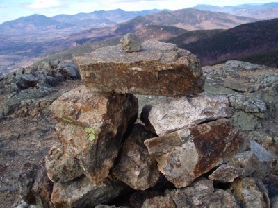
The North Moat summit was a fine spot for break and a look around, the only company the wind, moving clouds overhead, incredible landscape and stagnant cairn. The trail soon dives back down into the coniferous forest and into a narrow knoll with sporadic widening ledges before a junction marked by boulders and the Red Ridge Trail.
Red Ridge was rather kind at the onset, soon leaving the trees before breaking out to a stunning area of vistas, rock, ledge and scrub. This was above tree line below the trees. The way was slow-going. Not because of the terrain, but because of the landscape. It was familiar terrain seen from an unfamiliar vantage point.
But truth is, aside from a few playful dips and a gravelly section, the majority of the rest of Red Ridge was mundane, a trudge back through sporadic pockets of muck to Lucy Brook and back to the Moat Mountain Trail.
Having only seen a trio of hikers on the Red Ridge, there were many hellos back by Diana's Bath including a pleasant exchange with one of the most accomplished of White Mountain hikers on a little walk with visiting relatives, a hiker who has behind the scenes offered sage advice to me along the trails for years.
Many hikers may bypass the Moats for its bigger four-thousand foot tall neighborhoods. Though the way is easy for the masses to Diana's Baths, there are some lofty challenges up along the bare and rocky range. For those who consider it the road less taken, it's time to make a beeline for it.
Marty Basch photo